
Surveying and Mapping
1 , Topographic mapping : Hangzhou Xiaoshan District 1:500 full field digital topographic mapping Topography is the city of the national economy specialized departments to carry out investigation , planning, design and construction stages versatility surveying and mapping work . Due to the large scale topographic mapping can accurately reflect the surface detail of objects and phenomena , so the city accustomed to large-scale topographic mapping measurement , large scale topographic maps ( 1:500-1:5000 ) is a large -scale topographic mapping direct result .

2 , The second land survey ( the second national land survey in July 1, 2007 started in 2009 completed surveys main tasks include: rural land survey , to identify each piece of land land type , location, scope , size distribution and ownership , etc. ; urban land investigation , grasp each land boundary , scope, boundaries , quantity and purpose ; basic farmland investigations into basic farmland protection block ( block ) the implementation of land use map on and register on the card, inventoried ; establish land use database and cadastral information system , to achieve interconnection of survey information sharing in the investigation on the basis of changes in land resources information to establish the statistical , monitoring and fast update mechanisms second land survey as a major national survey , the purpose is to identify a comprehensive national land use situation , grasp the real land base data, and survey results of the implementation of information technology, network management, establish and improve land surveys , statistical systems and registration system realization of land resource information society services to meet the economic and social development, land macro-control and land resource management needs. ) : Cixian , Shexian , Shing , Handan County , Jinan, Yantai five areas ( urban part )
.jpg)

3 ,The three powers ( collective land ownership certification , the collective construction land use right certification , the homestead use right certification ) : Shexian, Cixian, Cheng’an,Daming, jize
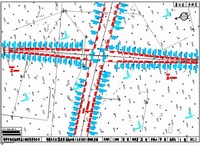
4 ,Demarcation : Shi Wu high-speed railway passenger line Handan section project
.jpg)


5 , Census names : ( " census names " is a work of the government , means implemented by the government , or some administrative districts nationwide to conduct a comprehensive survey of the names behavior . Census names to help the Government to fully grasp and understand the national or the names of a state administrative district government according to the results of the census of certain names be changed. census names also help facilitate their own people or foreign tourists travel , moved or settled . currently experiencing secondary census names , The time interval for 30 years. )
Urban and Rural planning ( Yongnian ,Daming,Shexian)
To the scientific development concept as a guide , fully implement the CPC Central Committee and State Council on vigorously promote urbanization policies and arrangements , mainly engaged in urban and rural planning, detailed planning, industrial development planning , residential planning and design services.
Yongnian

Daming

Shexian

Land remediation planning ( Cixian , Shexian ,Cheng’an ,Daming, HandanXian )
To the scientific development concept as a guide , fully implement the CPC Central Committee and State Council on vigorously promote land remediation decisions and arrangements to implement the " two most stringent " land management system , and promote urban and rural development and new rural construction as the fundamental purpose , around the "butt big city , continuing to promote city development, industrial agglomeration, New linkage, cultural innovation, ecological priority , livelihood -oriented " overall development strategy , in order to effectively safeguard and protect the interests of farmers as the premise, and vigorously promote the agricultural land consolidation, to accelerate land reclamation and development , regulate and promote rural construction land remediation, encourage urban construction land remediation, increasing the effective area of arable land , improve land quality and food production capacity, improve the ecological environment of land , coordinating land remediation and farmland protection, industrial development and the relationship between urban and rural construction , co-ordinate arrangements for land development and consolidation of land reclamation and other remediation activities .
Cixian
APP·官方网站 5/磁县.jpg)
Shexian
APP·官方网站 5/涉县.jpg)
Cheng’an
APP·官方网站 5/3-0成安县土地整治项目规划图.jpg)
Daming
APP·官方网站 5/3-0大名县土地整治项目规划图.jpg)
HandanXian
APP·官方网站 5/4-1.邯郸县土地整治项目布局图.jpg)
Land planning (Cixian , Shexian ,Cheng’an ,Daming, HandanXian )
To fully implement the scientific development concept, building a comprehensive well-off society and promoting the integration of urban and rural construction, protection of the county population, resources , environment and economic and social comprehensive, coordinated and sustainable development , based on " on the issuance of the General Office of the Ministry of Land and counties and township land use overall planning guidance notice " ( MLR hall hair [ 2009 ] No. 51 ) and other documents required in order to" Handan City land use Planning ( 2006-2020 ) " as guidance, implement the most stringent farmland protection system and conservation land use system as the guiding ideology . Round planning period 2010-2020 to 2009 as the base year , 2015, the target year for the near future , the planning target year 2020 .
Cixian

Shexian

Cheng’an

Daming

HandanXian

Basic farmland (Cixian , Shexian ,Cheng’an ,Daming, HandanXian )
The permanent protection of basic farmland demarcated , is to implement the basic national policy of land and land management laws and regulations , the implementation of land use planning, an important measure to strengthen the protection of farmland , is to determine the quality of basic farmland protection area and an important means for optimizing structures and agricultural land layout , strict farmland protection and conservation of intensive land use system, and promoting economic development and resource use pattern.
Land reclamation plan establishment
Handan to daimyo ( Ji Lu circles ) motorway temporary land land reclamation schemes 2011.4
Han Ji Railway Capacity Expansion Handan City in the temporary land land reclamation schemes 2011.4
HanChang Railway Capacity Expansion Handan City in the temporary land land reclamation schemes 2011.4
,Hebei Province Shijiazhuang to Cixian ( JiYu Boundary) highway expansion project in Xingtai , Handan territory of temporary land land reclamation scheme 2011.12
Hebei Province Zhuozhou to Shijiazhuang (JingJi Boundary ) highway expansion project temporary land land reclamation program report 2012.12
XingHeng highway Hengshui section project temporary land reclamation program report 2012.10
Jingdian Town, SheXian mining waste land reclamation program report 2013.1
Jizhong Energy Handan Mining Group Mining Co., Ltd. Guo Guo two two Zhuang Zhuang mine land reclamation program
Cixian new residential model village construction land reclamation program
Qiuxian new residential model village construction land reclamation program
Daming County new residential model village construction land reclamation program
Quzhou County, new residential model village construction land reclamation program
Shexian new residential model village construction land reclamation program
Jize new residential model village construction land reclamation program
Cultivated land quality levels defined ( Congtai District , HandanXian , Shexian , Cheng’an ,Jize , Guangping )
Based on the latest survey conducted arable land quality level results improve the work , and land use survey of convergence , and gradually establish regular surveys of cultivated land quality grade evaluation system , land quality grading annual reporting system, improve the quality of arable land evaluation results accuracy.
Congtai District

HandanXian

Shexian

Cheng’an

Jize

Guangping

Lebp investigation ( HandanXian , Shexian , Cixian , Cheng’an, Jize , Daming)
Formulation and implementation of land area price is the explicit request of the State Council , is the law reasonably good land compensation and resettlement work , maintaining the vital interests of landless farmers , protect the healthy development of economic infrastructure work ; work is to solve the current existing land requisition compensation standard is low, the same place different price , increasing randomness and other outstanding issues of important initiatives. Develop and implement standard price of the land area is to create the most stringent farmland protection system, implement the scientific concept of development of the substance , for the promotion of the implementation of urban development strategy, maintain social and economic stability and development of great significance .
HandanXian

Shexian

Cixian

Cheng’an

Jize

Daming

Land grading standard land price updates ( Jize )
Land is land on sale , sale and transfer of such trading activity is shown by the price of the property is directly reflected land assets . The benchmark land in urban planning area , for different levels of land or land condition fairly homogeneous regions, in accordance with the commercial, residential , industrial and other uses were evaluated and municipal people's governments above the county announced by state-owned land use the average price of the right , is the right to use the land for various regional average prices, using the corresponding period of the statutory maximum of Land transfer period , commissioned by the government , organization or assessment of the results is subject to government approval.

Intensive land use evaluation ( SheXian )
Land Intensive Use Evaluation work carried out for the control of blind expansion zone to promote development zone inefficient land potential, improve the management level development zone land , establish and improve the economical and intensive land use zone appraisal system and long-term mechanism to enhance the land involved in macro- regulate the ability to build a resource-saving society.
—按建设状况划分.jpg)

