Handan Hengda Geographic Information Engineering Geographic Ltd., headquartered in Handan, Hebei Province Economic Development Zone . Formerly known as China , China Metallurgical third engineering company mapping team , attached to the original MCC . March 2005 in accordance with the national " separation of major " restructuring requirements , incorporated Handan City Hengda Geographic Information Engineering Co., Ltd. ( hereinafter referred to as Hengda company ) , as the company continues to expand and businesses continue to grow, 2010 May has incorporated Hengda planning and Design Co., Ltd. Handan , Handan City Hengda Real Estate Development Co. , Handan City, Jinhua land remediation Limited . Companies registered capital of 25 million yuan , office area of 5,000 square meters. The company has a national qualification mapping , land use planning B qualification , urban and rural planning C qualification .
We always adhere to the " integrity and pragmatic, strict fine and efficient" business philosophy , to implement and practice the scientific concept of development as guidance, earnestly : continuous improvement, building made fine works , to achieve customer satisfaction ; integrity of the law , strengthen environmental construction, protection safety and health . Companies adhere to market -oriented to service customer satisfaction focus, with good management , good reputation , to achieve sound and rapid development of the Group .
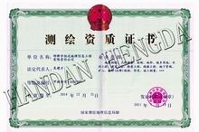
May 27, 2011 , the National Mapping Geographic Information Bureau issued this certificate .
Corporate Culture is "people- oriented, harmonious development " and this philosophy is reflected in each employee's work.
( 1 ) Establish refined , efficient, unified , in line with the characteristics of the company to ensure efficient operation of production and business activities of regulatory agencies.
( 2 ) To establish a moral character, excellent technical , work in an orderly , hardworking , upright style of the workfteam , and constantly improve the economic benefits of the company and the company's market competitiveness, and to ensure that the legitimate interests of employees .
Provincial Geographic Information Bureau organizational learning national " two sessions" spirit
Recently, the provincial Party Geographic Information Office held a working meeting, organizational learning, the national "two sessions" in the spirit of the deployment of measures for implementation.
It was noted that the victory had just concluded national "two sessions", the consideration and approval of the government work report and other important reports, reviewed and approved by the State Council institutional reform and functional transformation program, elections and determine the new state agency leaders and the CPPCC National Committee leadership, democracy, unity, pragmatic, progressive meeting. Important achievements of the General Assembly, for building a moderately prosperous society...
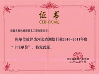
July 2012 , the National Mapping Geographic Information Bureau issued this certificate
more...1 , Topographic mapping : Hangzhou Xiaoshan District 1:500 full field digital topographic mapping Topography is the city of the national economy specialized departments to carry out investigation , planning, design and construction stages versatility surveying and mapping work . Due to the large scale topographic mapping can accurately reflect the surface detail of objects and phenomena , so the city accustomed to large-scale topographic mapping measurement , large scale topographic maps ( 1:500-1:5000 ) is a large -scale topographic mapping direct result .
2 , The second land survey ( the second national land survey in July 1, 2007 started in 2009 completed surveys main tasks include: rural land survey , to identify each piece of land land type , location, scope , size distribution and ownership , etc. ; urban land investigation , grasp each land boundary , scope, boundaries , quantity and purpose ; basic farmland investigations into basic farmland protection block ( block ) the implementation of land use map on and register on the card, inventoried ... ...
No Information
The mapping and surveying is short for Measurement and cartographic mapping . Measurement is to obtain the shape of the earth reflects , Earth's gravity field , the Earth 's natural and social elements of the position, shape , spatial relations , regional spatial structure of the data . Cartography of these data is processed , analyzed or after synthesis and use them as a form of expression .
Establishment of a national geodetic datum coordinate systems and projections national geodetic control network geodetic coordinates of each point of the fundamental basis , which includes a set of geodetic parameters and a set of initial data , which geodetic parameters include the establishment of geodetic coordinates as the basis for the Earth ellipsoid four constant equatorial radius of the Earth ellipsoid , ah, gravity constant GM, dribbling harmonic coefficients J2 ( derived therefrom ellipsoid flat rate f) and the Earth's rotation angle w, and used to determine the geodetic coordinate system and the geodetic control network length basis vacuum speed of light c; while a set of initial data refers to the state geodetic control network starting point ( origin of the earth to become ) the geodetic longitude , geodetic latitude , geodetic elevation and direction to want to neighbor geodetic azimuth .
The geoid is the surface of the sea to the mainland by a stationary extended closure formed by irregular surfaces. It is the gravity equipotential surface , i.e. when the object along the plane motion , gravity no work ( water in this surface is not flowing ) . The geoid is to describe the shape of the earth is an important physical reference surface is the surface elevation starting system . Geoid was determined by reference ellipsoid to determine its pitch - geoid ( geoid for the purpose , it is called height anomaly ) to achieve. Geoid and elevation and other parameters and concepts in the objective world is everywhere, in the national economy plays an important role . The geoid is one geodetic datum to determine the geoid is a national basic surveying and mapping in an important project. It Geometric Geodesy and Geodetic Science combined, so that people in determining the spatial geometry at the same time , but also get altitude and the Earth gravitational field relations and other important information . Geoid shape reflects the Earth's interior structure of matter , density and distribution of information on oceanography , seismology , geophysics , geological exploration , oil exploration and other related earth science and applied research in the field has an important role .
Height Datum is projected elevation control network of national unity for all levels starting elevation basis , which includes a standard base and a permanent level origin . Level datum , usually theoretically using the geoid , which is an extension to the global stationary sea water, the Earth's gravity is an equipotential surface , in fact, determine the level of the base surface is to take the long-term tide gauge observations calculated average sea . China to Qingdao Port tide gauge long-term observations of the Yellow projected mean sea level of the base surface as China , that is, zero elevation surface . Standards established in Qingdao, China origin tide station nearby and constitutes the origin network . Measured with a precision leveling leveling origin relative to mean sea level elevation Yellow , that the origin of the elevation level , as the national vertical control network starting elevation .
Gravity is the absolute gravity reference values known gravity point , as a relative gravity measurements ( the difference between two gravity gravity measurements ) starting point. Recognized worldwide as the starting point known as the International Gravity Gravity benchmark . States in gravity measurements are possible with the international gravity base linked to test its gravity measurement accuracy and to ensure the unity of measurement results . Internationally accepted benchmark has 1909 Potsdam Gravity Gravity baseline and 1971 international gravity base network (IGSN - 71). China in 1956 to 1957 to establish a nationwide first national gravity base , called the 1957 national gravity base net , the network consists of 21 basic points and 82 first-class points. In 1985, China re- established national gravity base . It consists of six benchmarks gravity points, 46 points and five basic gravity because of dots , called 1985 national gravity base net .
Earth's gravity field is a physical property . Characterization of the Earth's interior , surface or external points suffered Earth gravity of space. According to the distribution of Earth's gravity field , you can study the Earth's internal structure, the shape of the earth as well as the impact on the spacecraft .